Skip navigation
Navigation
Hennepin County, Minnesota
  • Subscribe
  • Jobs
  • Employees
  • Media
  • Contact
  • Home
  • Residents

    Information and services

    • Residents

      Information and services

      • Conservation
      • Elections
      • Emergencies
      • Health and medical
      • Human services
      • Libraries
      • Licenses, certificates and permits
      • Property
      • Public safety and law
      • Recreation
      • Recycling and hazardous waste
      • Transportation
  • Business

    Regulations and opportunities

    • Business

      Regulations and opportunities

      • Conservation
      • Licenses and permits
      • Property
      • Recycling and hazardous waste
      • Work with Hennepin County
  • Your government

    Leadership and engagement

    • Your government

      Leadership and engagement

      • Budget and finance
      • Facilities
      • Get involved
      • Leadership
      • Open government
      • Ordinances
      • Overview
      • Projects and initiatives
      • Research and data
  • Online services

    Transactions and applications

    • Online services

      Transactions and applications

      • Apply
      • Ask
      • Search
      • Pay
      • Report
      • Schedule
      • Learn
Hennepin.us
Search

Hennepin County > Conservation > Priority watersheds for soil and water conservation

Priority watersheds for soil and water conservation

Several priority watersheds around Hennepin County include bodies of water that have become polluted or impaired. These include Rush Creek, Lake Independence and Diamond Creek.

Priority watersheds are geographies that have been identified by a local or state agency as priorities for reducing pollution such as phosphorus, nitrogen, sediment, and E. Coli  to improve the water quality of nearby lakes, streams, or rivers.

Priority watersheds boundary search map

Kevin Ellis, conservation specialist

kevin.ellis@hennepin.us

Phone: 612-382-3956

Cost share for conservation interest form
Open all
Cost share funds available

Funding is available for projects on farms in Hennepin County's priority watersheds. The project must improve water quality and farm management. Upgrades can make management easier and help support animal and soil health.

If you think you have a potential cost share for conservation project, we want to hear from you! Contact us here: Cost share for conservation interest form.

Use of funds

Financial assistance is available for Hennepin County residents ranging from 75-90% of the cost to implement a project, with the landowner being responsible for the remaining percentage. Projects located in priority watersheds are eligible for up to 90% cost share.

The amount of financial assistance depends on the location, type of project, and other factors, and is determined prior to construction. You are reimbursed after the project is installed. During project development and design, you also receive technical assistance.

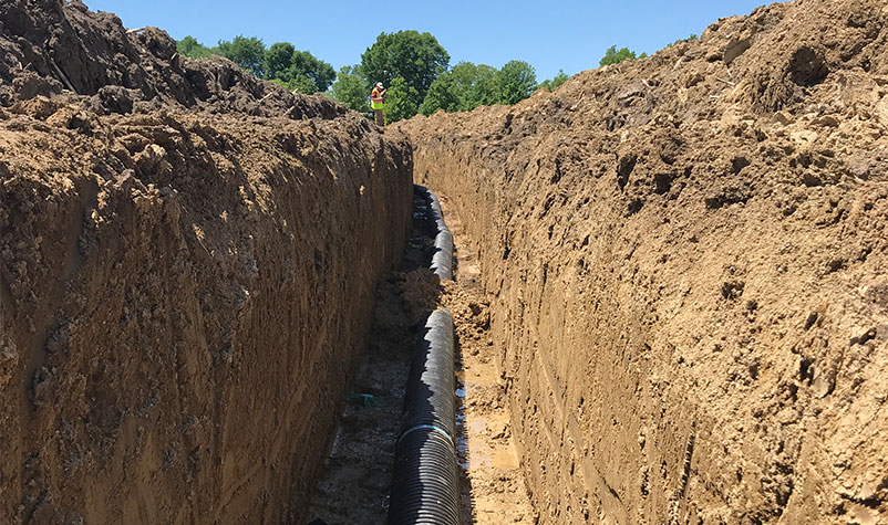
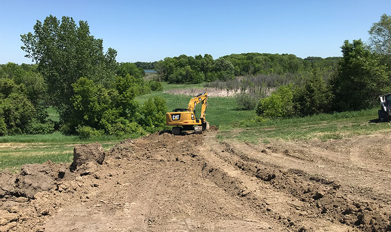
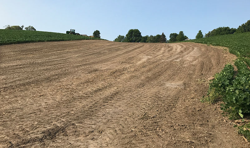
Funding can be used for conservation practices such as:

  • Wetland restorations
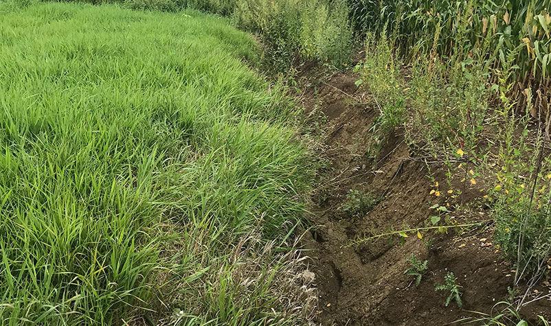
  • Washout and gully repairs
  • Horse and livestock management (waterers, fencing for rotational grazing, manure bunkers, etc.)
  • Grassed waterways
  • Soil health practices such as cover cropping, reduced tillage, and diversifying crop rotations
  • Wildlife and pollinator habitat that protects and improves soils
  • And much more!

Future Funding

While most funding for conservation projects in Hennepin County is concentrated in the priority watersheds of Rush Creek, Diamond Creek, and Lake Independence, future watershed assessments may identify other areas that require special attention. Please contact staff to get the latest information on current or future priority watersheds.

Project examples

Problem

Crop fields on areas with sloping or highly erodible soils can often lead to soil and nutrients ending up in waterways from surface runoff.

Solution and result

Use of Clean Water Fund grant funds in the Rush Creek subwatershed were leveraged to construct several practices, including a grassed waterway (pictured below) to reduce the runoff. When vegetation gets established in the waterway, it slows down runoff, which helps to reduce major sources of erosion and phosphorous while ultimately keeping productive soil in its place on the fields.

The overall result is less runoff and better water quality.

Story

A farmer in rural Corcoran was having issues with runoff from a steep, sloped field. In addition to producing less crops, the slope contributed to runoff, which reached a nearby lake, leading to water quality issues.

After working with Hennepin County, the landowner was able to install a waterway, sediment control basin, and subsurface drainage. The waterway directs excess water off the fields and into the nearby lake, while the control basins allow soil to settle before running off.

Before, during, and after construction

The pictures here show the progress of the project throughout construction.

Erosion occurring next to the field before starting on the project.

field erosion outside

View of the drain tile that went directly below the grassed waterway.

drain tile under the soil

Finishing up grading the soil and burying the tile.

machine on soil outside

Completed waterway structure prior to seeding it with grass to reduce erosion.

field of soil

Contact

To learn more about potential projects and funding, or to set up a field visit, please fill out this online form: Cost share for conservation interest form.

Kevin Ellis, conservation specialist
kevin.ellis@hennepin.us
612-382-3956

Watershed assessments

Every two years, the Minnesota Pollution Control Agency (MPCA) evaluates all waters within the state and creates a list of impaired waters, which are water bodies that fail to meet water quality standards. Though there are many pollutants that can contribute to a water quality impairment, Hennepin County most commonly works to address phosphorus, sediment, dissolved oxygen, and bacteria by doing water quality projects with private landowners. To determine where pollutants are coming from, Hennepin County assesses pollutant contributions to the watershed using computer models.

Hennepin County and its partners work to implement water quality projects with private landowners that reduce pollutants and move towards getting water bodies de-listed from the impaired waters list. Watershed assessments can help determine where it makes the most sense to focus efforts based on a number of factors, such as:

  • The amount of pollution a project will remove from an impaired water body
  • How much a project will cost
  • The cost-effectiveness of the project (in other words, how much the project costs relative to the amount of pollution it will remove)

Priority watersheds are geographies that have been identified by a local or state agency as priorities for reducing pollution such as phosphorus, nitrogen, sediment, E. Coli, etc. to improve the water quality of nearby lakes, streams, or rivers. Hennepin County and its partners have completed watershed assessments to identify water quality improvement opportunities for the following priority watersheds:

  • Rush Creek watershed
  • Lake Independence and Lake Sarah watersheds
  • Dance Hall Creek watershed
  • Lake Ardmore watershed
Reducing pollution in Hennepin County

Impaired waters

Many lakes, rivers and streams experience high levels of bacteria, sediment from erosion, and nutrients. Nutrients in water bodies can make it a hard place to live for fish, bugs, and other critters that use it as habitat. Bacteria make it unsafe for recreational uses. Areas with elevated levels of sediment, nutrients or bacteria are designated as an impaired water by the Minnesota Pollution Control Agency (MPCA).

Learn more about Impaired Waters in Minnesota at the MPCA's website: Minnesota’s impaired waters list.

Phosphorus

Phosphorus can contribute to excess algae blooms, which can reduce usability of a water body for recreation. It can also lead to oxygen depletion (eutrophication), which harms wildlife.

Phosphorus has been found in excess levels at:

  • The North and South Forks of Rush Creek
  • Lake Henry
  • Lake Sarah
  • Lake Independence
  • Dance Hall Creek
  • Lake Ardmore
  • Diamond Lake

Sediment

Too much sediment in a water body can make the water cloudy. This can harm wildlife and cause oxygen depletion.

Sediment has been found in excess levels at:

  • Diamond Lake
  • Diamond Creek

E. Coli

E. Coli is a type of bacterial pollutant that can reduce usability of a water body for recreation.

E. Coli has been found in excess levels at:

  • The North and South Forks of Rush Creek
  • Diamond Lake

Dissolved oxygen

If dissolved oxygen is too low, it can make it more difficult for fish to breathe. If levels reach a certain point, it can cause fish to die off, which can harm the local ecosystem.

Dissolved oxygen is too low at:

  • The North and South Forks of Rush Creek
  • Diamond Creek
  • Open all
    • Home
    • Residents
    • Business
    • Your government
    • Online services
    • Subscribe
    • Jobs
    • Employees
    • Media
    • Contact

    Follow us

    • Facebook
    • X
    • Instagram
    • YouTube
    • LinkedIn

    Accessibility | Privacy | Open Government | Copyright 2025

    Hennepin County
    Top